Aerial Photography & Video
San Diego, CA
- FAA Certified Drone Pilot
- Fully Insured
- Easy to Work With

About Us
We believe in quality over quantity & completing a job right the first time for a reasonable rate. Our exceptional attention to detail & commitment to customer service, set us apart from our competition.
We provide aerial photography services. Our focus is on using drones for aerial inspections, construction progression reporting, 2D mapping, & 3D modeling.
Services
2D mapping
3D reference models
Aerial inspections
Videos
Some of the assets we can create...
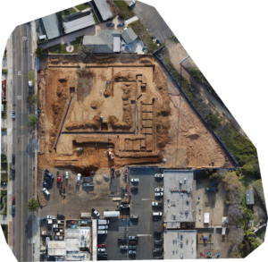
Orthomosaic images
An orthomosaic image, or orthophoto, is a composite image made from many individual images. Using specialized software, we are able to stitch the images together to create a large, very detailed image.

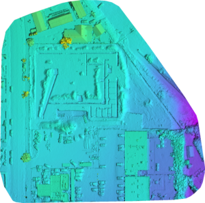
Digital Surface Models
A digital surface model, or DSM, uses the data from the orthophoto to create an elevation reference model. This allows you to see the surface contours & elevation changes of the area.

Videos
An orbit video of a project site allows you to get a real-time view of the area & some of its surroundings. It offers a unique perspective & helps bring the project to life.
3D models
A 3D model of a project site allows you to explore the details of the area & see it from many different angles. You can observe the surface, elevations, & objects to get a more in-depth visualization of the area.
